HEC-RAS 2025 Wish List + Start to Finish Model Guide
Introduction
I decided to take HEC-RAS 6.7 beta out for a test drive, tracking a running wish list of beta testing comments along the way while setting up a model from scratch. Recognizing that the legacy version will be outdated soon, there may not be a whole lot of incentive to update it, but perhaps some of the suggestions could be incorporated into the new RAS 2025 interface as it is rolled out!
For this particular project, we pick up where we left off at the end of the HEC-RAS Hollywood Movie Trilogy. In true disaster movie style, we try to rebuild the berm around Disneyland to see how it would hold up to a mega-tsunami from one direction and a dam breach flood wave from the other (perhaps caused by the same earthquake or meteor strike!) Here’s a time lapse of a 1950s-era photo showing the original berm against a current Google Earth image showing some gaps in the berm:
Here’s what it looks like from the same vantage after running the model:
[Good thing the Millennium Falcon is equipped with pontoons so it can land on water – according to Wookieepedia!]
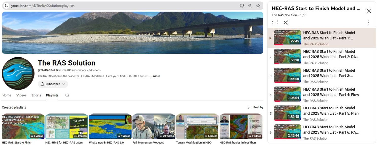
RAS Solution YouTube Playlist
The accompanying video recordings are available as a 6-part playlist on the RAS Solution YouTube channel running approximately 8 hours in total. Check out additional modeling tips and tricks on the RAS Solution and subscribe to be updated when new videos are released:
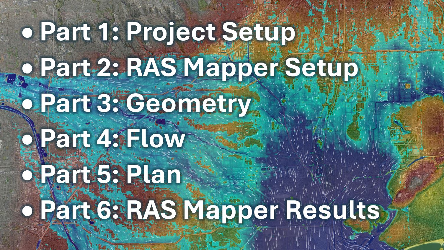
Here are the topics covered in the playlist:
Written Instructions
If you are new to HEC-RAS, you may wish to follow along with the video playlist and create your own model from scratch by adjusting the playback speed or pausing and repeating as we set up, run, and interpret the model results. An accompanying pdf workshop guide is also available for free download here. The pdf workshop guide includes this schematic image of the HEC-RAS file setup:
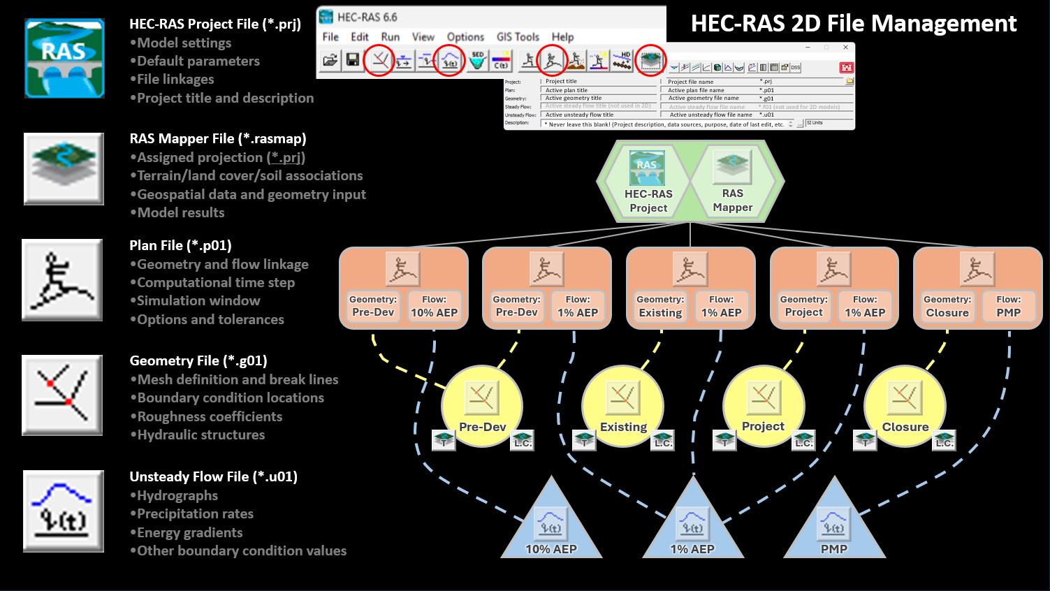
Regardless of your level of experience with HEC-RAS or other models, we would appreciate hearing about any additional tips & tricks of your own! Please submit them through the comment form here.
Part 1: Project Setup
Part 1 covers the following topics (bookmarked in the video recording):
- Downloading and installing HEC-RAS
- Setting up a folder structure
- Creating a new project
- HEC-RAS documentation
- Set default directory and units
- HEC-RAS 2025 previe
Part 1 wish list items:
1.1: Live updates for Version 6
1.2: Project folder structure
1.3: Unique project file extension [already added to 2025!]
1.4: Date column for opening project files
1.5: Allow longer files names with spaces and hyphens
1.6: Longer recent files list
Part 1 referenced links and resources:
• HEC-RAS 6.6 and example data download: https://www.hec.usace.army.mil/softwa…
• Release notes: https://www.hec.usace.army.mil/conflu…
• New features: https://www.hec.usace.army.mil/conflu…
• Resolved issues: https://www.hec.usace.army.mil/conflu…
• HEC-RAS Documentation: https://www.hec.usace.army.mil/conflu…
• Known Issues: https://www.hec.usace.army.mil/conflu…
• HEC-RAS 2025 launch website: https://www.hec.usace.army.mil/fwlink…
• HEC-RAS 2025 announcements page: https://www.hec.usace.army.mil/fwlink…
• RAS Solution Blog: https://therassolution.kleinschmidtgr…
• Australian Water School HEC-RAS Playlist: ![]() • HEC-RAS 6.0, what you need to know: P…
• HEC-RAS 6.0, what you need to know: P…
• RAS Commander: ![]() / @gpt_commander
/ @gpt_commander
• HEC-RAS ChaptGPT: https://chatgpt.com/g/g-iJx0X5UgK-hec…
• HEC-RAS LinkedIn Group:  / 1908568
• HEC-RAS Facebook Group:  / 90473474105
Part 2: RAS Mapper Setup
Part 2 covers the following topics (bookmarked in the video recording):
- Set projection
- Download U.S. terrain data
- Download international terrain data
- SRTM terrain data limitations
- Create new RAS terrain
- Download elevation data
- Check terrain data
- Vector terrain modifications
Part 2 wish list items:
2.1 – Show active projection in main RAS Mapper window
2.2 – Add direct download for terrain data outside U.S.
2.3 – Allow NAD83 (2011) projections
2.4 – Default to update legend with view
2.5 – Default to add new terrains on top not bottom of order
2.6 – Add refresh button or refresh opacity automatically
2.7 – Remove profile data over no-data areas
2.8 – Keep create and edit features buttons active/uncovered
2.9 – Fix profile plots for modified terrain
2.10 – Fix priority order for terrain modifications
2.11 – Add “replace no-data values” modification method
2.12 – Show terrain coverage preview
Part 2 referenced links and resources:
• USGS EarthExplorer: https://earthexplorer.usgs.gov/
• NOAA Data Access Viewer: https://coast.noaa.gov/dataviewer/
• SRTM Digital Elevation Models User Guide: https://www.ga.gov.au/bigobj/GA18067.pdf
• Why all world maps are wrong: ![]() • Why all world maps are wrong
• Why all world maps are wrong
• Get your own map projection poster: https://store.dftba.com/collections/j…
Part 3: Geometry File
Part 3 covers the following topics (bookmarked in the video recording):
- Opening HEC-RAS files in a text editor
- Demo model overview
- Filtered and unfiltered terrain data
- Using modification tools to fix existing terrain
- Shapefiles
- Adding spatially varying roughness as a map layer
- Terrain modification methods
- Create new geometry
- Sub grid resolution concept overview
- Adding break lines and fixing red dot errors
- Adding refinement regions
- Geometry view options
- Adding a culvert
- Adding a bridge
Part 3 wish list items:
3.1 – Allow filter before query
3.2 – Fix file size glitch
3.3 – Turn on lengths and areas by default or with button
3.4 – Put new reference layers under map layers subfolder
3.5 – Add flow path and watershed/catchment delineation to HEC-RAS
3.6 – Apply consistent terminology to options and tabs
3.7 – Depth varying roughness
3.8 – Allow polygon modification layers to have side slopes
3.9 – Call values added to terrain “difference” not “elevation”
3.10 – Grey out/italicize computation points when empty
3.11 – Add number of cells and coverage area to perimeter layer properties
3.12 – Fix glitch with disappearing modification layers
3.13 – Add plan view station tracker for terrain mod profiles
3.14 – Add option to iterate “fix meshes” until all are fixed
3.15 – Default layer associations to highlight added feature
3.16 – Fix layer association glitch or prompt to save when exiting
3.17 – Turn fill in storage areas and points off by default
3.18 – Allow middle mouse button to pan
3.19 – Default to view computed extents
3.20 – Add CTRL Z for undo to geometric data editor
3.21 – Add “are you sure” prompt when moving 2D area
3.22 – Allow ESC button to untoggle edit commands
3.23 – Automatically update layer views to match RAS Mapper
3.24 – Option to automatically assign ground levels to culvert inverts
3.25 – Option to drop terrain to assigned culvert invert elevations
3.26 – Automatically assign GIS coordinates for multiple barrels
3.27 – Add option to assign rotated grid [has already been added to 2025!]
Part 3 referenced links and resources:
• Delineate watershed/catchment boundaries and flow paths using HEC-HMS: ![]() • HEC-HMS for HEC-RAS Users Part 2 of 4…
• HEC-HMS for HEC-RAS Users Part 2 of 4…
• Geospatial operations for overlapping polygons (Full Momentum Episode #27): ![]() • Episode 27: Hidden Secrets of RAS Mapper
• Episode 27: Hidden Secrets of RAS Mapper
• Geospatial operations for overlapping polygons (HEC-HMS for RAS Users #Episode4): ![]() • HEC-HMS for HEC-RAS Users Part 4 of 4…
• HEC-HMS for HEC-RAS Users Part 4 of 4…
• Depth-varying roughness hack with raster files: ![]() • What’s new in HEC-RAS 6.0 Part 6: Lan…
• What’s new in HEC-RAS 6.0 Part 6: Lan…
• Depth-varying roughness hack with vector files: ![]() • Full Momentum: An HEC-RAS Vodcast (Ep…
• Full Momentum: An HEC-RAS Vodcast (Ep…
• Best practices for 2D bridges (Full Momentum Episode #28): ![]() • Episode 28: 2D Bridges – Best Practic…
• Episode 28: 2D Bridges – Best Practic…
• HEC-RAS 2D Bridge Hydraulics: ![]() • HEC-RAS 2D Class: 4.3 – 2D Bridge Hyd…
• HEC-RAS 2D Class: 4.3 – 2D Bridge Hyd…
• Face points in HEC-RAS: https://www.hec.usace.army.mil/conflu…
• Cell centers, faces, and face points: https://www.hec.usace.army.mil/conflu…
• AI segmentation tools and HEC-RAS scripts: https://www.hydroschool.org/ai/
• 100-year time lapse photos with Google Earth: https://www.hydroschool.org/world/
• Download pdf manual: https://hydroschool.org/workshops/
Part 4: Flow File
Part 4 covers the following topics (bookmarked in the video recording):
- Boundary condition introduction
- External inflow boundary conditions
- Internal inflow boundary conditions
- External outflow boundary conditions
- External stage boundary conditions
- Precipitation boundary conditions
- Steady vs. unsteady flow theory
- Unsteady flow editor
- Additional rain-on-grid resources
- Rainfall-runoff vs. rain-on-grid theory
- Space-time for hydrologists
- Boundary condition summary tips
- HEC-DSS
Part 4 wish list items:
4.1 – Plot terrain under projected BC line
4.2 – Fix glitch with internal BC updates
4.3 – Assume blanks are zero flow
4.4 – Use dropdowns and prompts for BC types
4.5 – Use dropdowns and prompts for BC types
4.6 – Allow dragging to populate cells
4.7 – Increase default number of ordinates
4.8 – Include peak flow, time to peak, and total volume for simulation window [button is already there for min/max/vol for total time series!]
4.9 – Include maximum and minimum WSEL with stage hydrographs
4.10 – Grey out first value of hyetographs
4.11 – Sum up total rainfall depth
4.12 – Add CTRL-Z for undo in flow files
4.13 – Allow negative precipitation values for transmission losses
4.14 – Allow custom time increments
Part 4 referenced links and resources:
• HEC-RAS documentation for internal boundary conditions: https://www.hec.usace.army.mil/conflu…
• Full momentum vodcast #IC16 – points: ![]() • Episode 16: Dam Breach with a Subterr…
• Episode 16: Dam Breach with a Subterr…
• USACE Training Document TD-41: Steady vs. Unsteady and 1D vs 2D vs 3D modeling: https://www.hec.usace.army.mil/softwa…
• Internal vs external inflow hydrographs – HEC-RAS Spooky Halloween Special: ![]() • Halloween Special: Spooky things to l…
• Halloween Special: Spooky things to l…
• Rain-on-grid for HEC-RAS: ![]() • Rain on Grid Modelling with HEC-RAS
• Rain on Grid Modelling with HEC-RAS
• Rainfall-Runoff vs. Rain-on-grid: ![]() • HEC-HMS for HEC-RAS Users Part 1 of 4…
• HEC-HMS for HEC-RAS Users Part 1 of 4…
• Australian Rainfall and Runoff Guidelines, Book 2, Section 2.2: ARR Space-Time Representation of Rainfall Events: https://www.arr-software.org/arrdocs….
• HEC-DSS – an Introduction to the Data Storage System: ![]() • HEC-DSS an introduction to the Data S…
• HEC-DSS an introduction to the Data S…
Part 5: Plan File
Part 5 covers the following topics (bookmarked in the video recording):
- Create unsteady plan file
- Courant Number theory
- Variable time steps
- Optimising grid size, time step, and run times
- Selecting equation set – diffusion wave vs. full momentum
- Acceleration terms – concepts
- Setting up batch runs
- Error logs
- Project summary and model comparison
- Sensitivity run schematics
- Mass balance errors
Part 5 wish list items:
5.1 – Add a warning or caveat on tools that aren’t updated or kept current
5.2 – Change name of Short ID to “label”
5.3 – Automatically update Short ID everywhere
5.4 – Increase the allowable number of plans or warn when max is exceeded
5.5 – Default to future date for Excel compatibility
5.6 – Fix windows region compatibility
5.7 – Default to smaller time step or adaptive time step
5.8 – Set variable time step button to go straight to advanced time step control
5.9 – Allow Max:Min Courant Number factor of 2 or less instead of less than 2
5.10 – Match fixed time steps automatically
5.11 – Default to full momentum
5.12 – Add “(this project only)” behind the default values heading
5.13 – Reorder equation sets by level of complexity
5.14 – Include the term “Full Momentum” in the options where applicable
5.15 – Include guidance for rain on grid settings and tolerances
5.16 – Include equation set on the compute button
5.17 – Allow changes to the order of batch runs
5.18 – Allow changes to the order of plans or sort by date
5.19 – List units in error log
5.20 – Change defaults to more common values or allow custom defaults
5.21 – Improve schematic file structure with unique lines
5.22 – Allow changes to the order of plans or sort by date
Part 5 referenced links and resources:
• The Brunner Runner featured in free AI for HEC-RAS webinar: https://www.hydroschool.org/ai/
• Running man history: ![]() • The surprising origins of the Running…
• The surprising origins of the Running…
• Download pdf manual: https://www.hydroschool.org/workshops/
• Full Momentum vodcast Episode # 21 “Tidal Modelling” ![]() • Episode 21: Tidal Modeling Using HEC-…
• Episode 21: Tidal Modeling Using HEC-…
• Sediment transport with HEC-RAS online training course: https://awschool.com.au/training/sedi…
• Bridge scour in HEC-RAS discussion with Stanford Gibson ![]() • Advances in scour assessment
• Advances in scour assessment
• Corps of Engineers and HEC history links: https://www.hydroschool.org/hec/
• Full momentum vodcast episode #19 “Getting to know the computation options and tolerances”: ![]() • Episode 19: Getting to Know the Compu…
• Episode 19: Getting to Know the Compu…
• UK benchmarking study of 2D models: https://www.gov.uk/flood-and-coastal-…
• RD-51: HEC-RAS results for UK benchmarking study: https://www.hec.usace.army.mil/conflu…
• Monte Carlo analyses with the HEC-RAS Controlloer: ![]() • Powerful feature of HEC-RAS exposed
• Powerful feature of HEC-RAS exposed
• Monte Carlo analyses with MCBreach: ![]() • Dam safety modelling using McBreach
• Dam safety modelling using McBreach
• HEC-RAS documentation for computation options and tolerances: https://www.hec.usace.army.mil/conflu…
• HEC-RAS documentation for momentum conservation: https://www.hec.usace.army.mil/conflu…
• HEC-RAS documentation for diffusion wave derivation: https://www.hec.usace.army.mil/conflu…
• HEC-RAS documentation for selection of equation set: https://www.hec.usace.army.mil/conflu…
Part 6: RAS Mapper Results
Part 6 covers the following topics (bookmarked in the video recording):
- Viewing maximum depth
- Viewing velocity
- Model troubleshooting
- Plot maximum water surface elevation profiles
- Plot cross sections
- Plot time series hydrographs
- Plot cumulative volume hydrographs
- Plot WSEL time series at a point for rating curves
- Plot structure variables | hydrographs
- Render mode options
- Export max depth grid (.tif) and inundation extents (.shp)
- Export Google Earth kmz file
- Display and interpret Courant Number
- Display and interpret Froude Number
- Display and interpret maximum WSEL error
- Display and interpret depth x velocity (flood hazard)
- Display and interpret shear stress
- Display and interpret energy head
- Creating WSEL difference (afflux) maps with RASter calculator
- Creating depth difference (afflux) maps with RASter calculator
- Using the 3D Viewer
- Checking variable time step sensitivities
- Displaying hydraulic connectivity
- Wish list summary
Part 6 wish list items:
6.1 – Allow categories to be moved up and down for display order
6.2 – Allow layer order to be changed with clicking/dragging
6.3 – Allow CTRL and shift to select multiple layers or layer ranges to move or delete
6.4 – Prompt to save changes in RAS Mapper instead of autosaving
6.5 – Change default legend values for depth and velocity to reasonable range or allow custom program defaults
6.6 – Allow numerical entry for all opacity or transparency percentages
6.7 – Provide alternative max button showing max D, V, and WSEL from output time steps
6.8 – Recompute cell edge elevations along break lines when associations are changed
6.9 – Allow WSEL profiles and depth plots to animate together
6.10 – Allow multiple profile line selection for plotting multiple time series
6.11 – Allow selection of point and line to develop rating curves
6.12 – Allow orifice vs. weir flow to be shown for bridges in structure variable plots
6.13 – Show selected values from individual profiles in profile plot
6.14 – Provide automated generation of Excel files for profiles
6.15 – Allow adjustment of labels, legend location, and plan ID in profile plots
6.16 – Allow order of profile names to be changed
6.17 – Leave north arrow and > on once selected
6.18 – Allow north arrow to move or title to be edited/moved/removed
6.19 – Null out colours below plot tolerance, leave plot threshold on and saved for each project
6.20 – Fix rain-on-grid vector export times
6.21 – Include plan ID in output file names
6.22 – Add maximum Courant number display
6.23 – Add display of maximum WSEL error at individual profiles
6.24 – Default to reasonable values for shear legend
6.25 – Allow energy gradient to plot in profile view
6.26 – Allow 3D Viewer window to be resized
6.27 – Add aerial image draping and update legend with view in 3D Viewer
6.28 – Allow adjustment of vertical exaggeration in 3D Viewer
6.29 – Ensure inundation polygons recognize terrain modifications
6.30 – Fix leaks in closed levees
6.31 – Provide option to save window configuration and proportions to export screen shots with fixed resolution and ratio
6.32 – Allow individual rasters to be added to a virtual copy or clone of the terrain
6.33 – Allow terrain modification lines to have both cut and fill slopes
6.34 – Prompt to interpolate no-data values when present in terrain
6.35 – Default to have “update legend with view” toggled on
6.36 – Allow the RASter calculator to operate on all rasters not just results rasters
6.37 – Allow results to be added to map layers to enable display in geometry editor
6.38 – Allow all file extensions to be shown when pulling in terrains or reference layers
6.39 – Support addition of aerial photos in ecw format
6.40 – Provide option to measure slope in profile view with measure tool
6.41 – Add area delineation tool and allow area to be displayed for perimeters
6.42 – Add commas to area and length fields, leave on once selected, or turn on by default
6.43 – Provide option to compute cross sectional conveyance area [added in 6.7 beta #2]
6.44 – Show polygon centroids and allow display of latitude/longitude for measured lines
6.45 – Allow regular polygons to be created with optional rotation in polygon shape files
6.46 – Provide tool to slice polygons with polylines
6.47 – Allow undo without showing finished terrain modifications and save all vertex edits if ESC key is pressed
6.48 – Provide ability to rename Short ID in RAS Mapper without having to re-run the plan
6.49 – Allow fixed axis scales for profile plots
6.50 – Allow all variable contour lines to be exported as vector shape files
6.51 – Provide tracking of active plan view time step in time series plots
6.52 – Provide an animation recorder with user-specified frame rate
6.53 – Allow filters to be applied for terrain extraction before querying download data
6.54 – Allow internal polygon to be excluded from 2D Area with an internal perimeter boundary
6.55 – Keep displaying grids during editing
6.56 – Provide readout of max value within view on legend
6.57 – Delete break lines associated with refinement regions when refinement regions are deleted
Additional comments covered in Part 6 but relevant to other parts in this series:
6.58 – [Geometry] Provide option to plot Stage-Area curves for SA Areas
6.59 – [Flow] Avoid truncating precipitation values when pasted in from Excel or other software
6.60 – [Plan] Default to turn on 1D/2D iterations
6.61 – [Plan] Provide warning or error message recommending decreased time step where relevant
6.62 – [Program] Warn against opening other plans, geometries, or flow files when batched runs are in progress
6.63 – [Program] Fix terrain modification glitch for zipped files
6.64 – [Plan, Geometry, and Flow] Allow selecting multiple files for deletion in RAS Mapper or in plan, geometry, or flow windows
6.65 – [RAS Mapper] Avoid triangulating rain-on-grid water surface elevations at building edges or steep banks
6.66 – [RAS Mapper] Allow shape file text labels to be automatically moved instead of disappearing when overlapping
6.67 – [Geometry] Automatically update culvert US Sta and DS Sta to match GIS Sta
6.68 – [Geometry] Include shallow water roughness references for sheet flow/rain on grid
Part 6 referenced links and resources:
- HEC-RAS hardware recommendations: https://www.hec.usace.army.mil/conflu…
- Stanford Gibson’s reference lines video:
 • XS Average Velocity Results from a 2D…
 - Free Courant Number webinar:
 • From Courant to Saint Venant
 - Free Froude Number webinar:
 • Froude, Dude!
 - Free rip rap sizing webinar (including shear-based methods):
 • Riprap sizing in HEC-RAS version 6.1
 - RASter calculator tutorial:
 • What’s new in HEC-RAS 6.0 Part 2: RAS…
 - Flood hazard tutorial:
 • What’s new in HEC-RAS 6.0 Part 3: Flo…
 - Afflux map tutorial:
 • What’s new in HEC-RAS 6.0 Part 3: Flo…
 - Stanford Gibson’s weir video:
 • Modeling Weirs in HEC RAS 2D
 - Saved views and static imagery: https://www.surfacewater.biz/views/
- Using world files in RAS Mapper: https://www.surfacewater.biz/world/
- How wrong is your flood model? (free TUFLOW webinar):
 • How wrong is your flood model?
 - Tips and tricks for reviewing flood models (free Jacobs webinar):
 • Tips & tricks for reviewing flood models
 - Hydraulic structures free webinar (including 1D vs. 2D vs. 3D and converting between H and V):
 • Get Structured with Hydraulics!
 - TD-41 – 1D, 2D, vs. 3D modelling HEC publication: https://www.hec.usace.army.mil/public…
- RAS 2025 screenshot roadmap: https://www.hec.usace.army.mil/softwa…on grid
HEC-RAS Hollywood Movie Tour
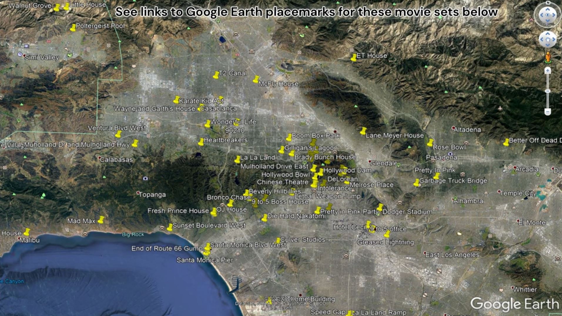
If you followed along with the model development, you now have all the terrain you need to try any of the example models from the HEC-RAS Hollywood Movie tour. Here are some of the movie and TV sets that we visited in that series:
Download the Google Earth placemarks here
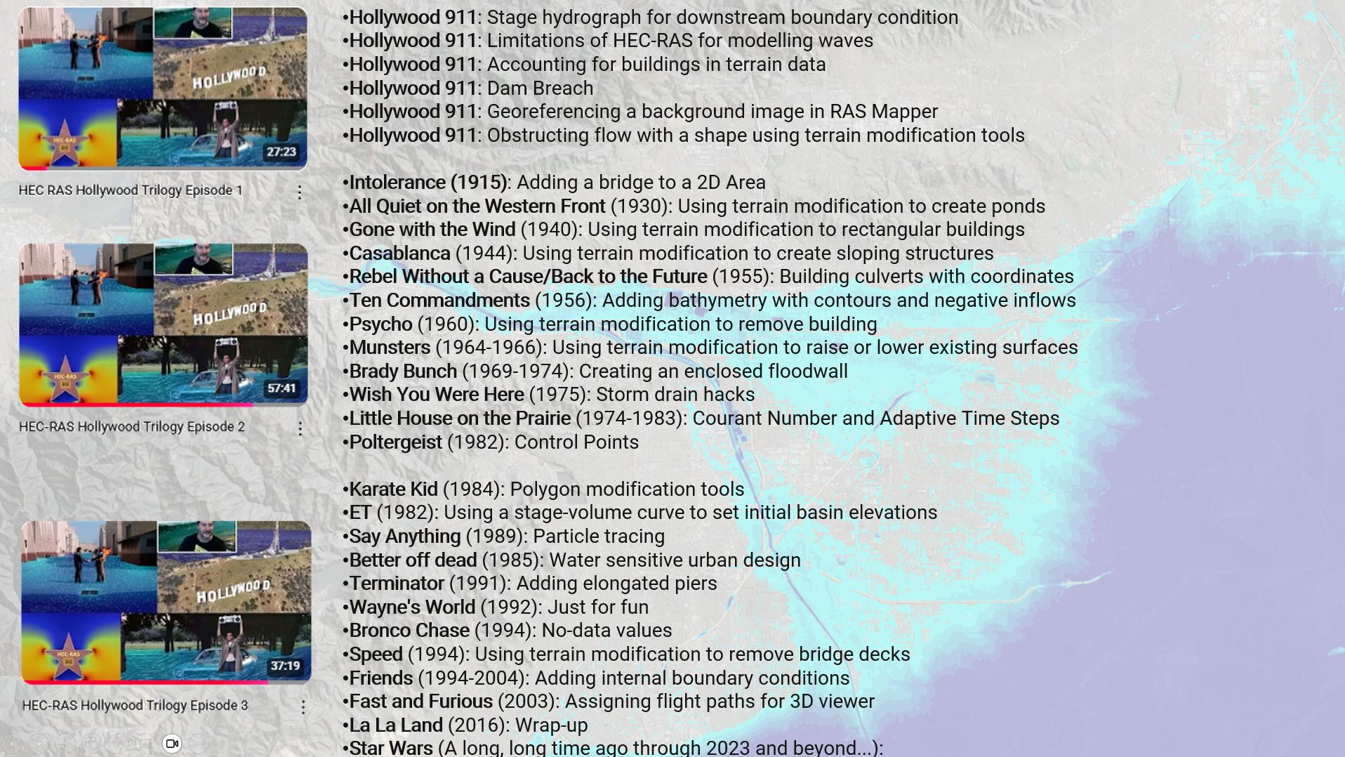
Here are the movie and TV sets that we used as a backdrop for the models along with the HEC-RAS skills and features that we highlighted at each stop:
Hope you enjoy the tour!
Feedback
We hope you found this walk-through valuable. Please provide any feedback through our contact form here.
Contact us to submit suggested topics or presenters for future content.

